|
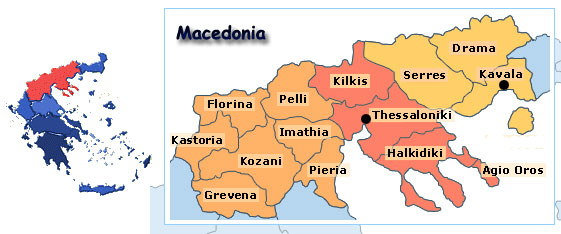
Regions of Greece : West Macedonia (Pella, Imathia, Pieria, Florina, Kozani, Kastoria, Grevena)
PREFECTURE OF PELLA (PELLI or PELLA)
General Information
The prefecture of Pella is situated near the upper center of Macedonia. It shares its eastern borders with the prefecture of Kilkis, its southern ones with the prefecture of Imathia, to the southwest with the Prefecture of Kozani, to the southeast with the Prefecture of Thessaloniki, while to the north lies the Former Yugoslavian Republic Of Macedonia (FYROM). The natural beauty of the landscape as well as its cultural heritage certainly consist an attraction of considerable interest. The region is characterized by the existence of many mountain ranges, such as Voras in which there is also a snow center, Paiko, Tzena, and Vermion. Near the ancient city of Pella there are fertile farmlands and picturesque lakes. Its population numbers 145797 residents, while its extent covers 2506 sq.km.
History-culture
The prefecture of Pella today lies on regions of ancient Macedonian lands such as Almopia, Imathia, Eordaia and Bottiaia, the birthplace of Alexander the Great. The region has been densely populated since Prehistoric Years. Before the arrival of the Macedonians, another Greek people, the Thracian tribes, had settled in this area, which held a key geographical position in terms of communication between East and West. Further back in time, other ancient Greek tribes occupied this region before moving to the south. Two major cities of antiquity were Edessa and Pella, with Edessa playing a significant part throughout the history of the region. Pella, built on the site of today"s village of Aghioi Apostoli but also known as Pella itself, prevailed in the late 5th century, when King Archelaus established it as the capital of his kingdom. Following up this decision, he built palaces in the city, fortified it with wall and castles, and he gathered around him some of the most celebrated artists and intellectuals of his time (Euripides spent there the last years of his life). In the time of Xenophon, Pella was the most significant city of Macedonia. Yet, following the decline of the Macedonian State, it was subjugated to the Romans who ravaged it ruthlessly. In the following centuries, the region was ravaged by repeated barbarian raids, due to its position of vital importance, as it is situated virtually on the route towards any direction. Tracing the same course in history with the rest of Northern Greece, Pella eventually came under Turkish occupation. In the area of Lake Giannitsa, some of the hardest conflicts of the Macedonian Fights against the Bulgarians (1904-1908) took place. The region was finally liberated in 1912, rejoining Greece after long centuries of foreign domination.
Sights
Visiting Pella requires many days of sightseeing. The region offers numerous spectacles of natural beauty and many archaeological sites of great importance. The capital of Edessa is one of the most beautiful cities in Macedonia, adorned with beauteous waterfalls and lush vegetation. In the area of Loggos, ruins of the ancient city have been discovered dating from the 4th century BC to the Palaeochristian Era, while the monastery of Aghia Triada (1865) is worth visiting as well. In Edessa, one can also see the parts of the medieval wall, the churches of Aghios Ioannis and the Assumption of the Virgin, the stone built tower with the six clocks, the stone built arched bridge dating from the Roman or the Byzantine years. Visitors should not fail to see the aforementioned waterfalls, situated in a verdant area that has been formed into a park; the hydroelectric plant of the Public Power Supply Company is powered by these waterfalls. The tourist stand in the area of Kavaliotissa is also worth visiting. In the town of Aridaia, renowned for its delicious fruits, red peppers and mineral water springs, visitors can see the house of Menelaos Lountemis, a great figure of Greek literature, the Palaeochristian cemetery (6km to the SE) and the ruins of a castle (7km to the E). A little further, there are the ruins of Palaeochristian buildings and basilicas. The remnants of a Prehistoric necropolis lie in Arnissa while the most significant site, that of ancient Pella is situated in the area of Giannitsa, between the villages of Old Pella and New Pella. Excavations have revealed parts of the palace, the marketplace (agora), cemeteries, baths, housing, and more. Just outside Skydra, a prehistoric settlement is also worth visiting. Many more castles and Byzantine churches can be seen throughout the prefecture, always surrounded by a striking natural environment. All things considered, the region of Pella is a most interesting and charming tourist destination, where the works of man are always complimented by even greater works of nature.
PREFECTURE OF IMATHIA
General Information
Once the first capital of the Macedon kings, the Prefecture of Imathia is one of the most prominent prefectures of Macedonia. To the south it shares borders with the prefecture of Pella, to the east with the prefecture of Thessaloniki, to the west with the prefecture of Kozani, and to the southeast with the prefecture of Pieria. Imathia holds its charms all seasons of the year. There are two organized skiing resorts atop Mount Vermion, both of the highest standards. The joys of skiing are available here for everyone, as organized pistes operate for all levels of skill, from novice to pro. Those who seek unique adventuring in the mountains can find it within the fabulous cedar and fir forests. The ancient city of Vergina is one of the most spectacular archaeological sites in Greece. The population of the prefecture reaches is about 140000 residents, while its extent covers 1700 sq.km.
History - Culture
As related in ancient tradition, the legendary king of Macedonia Veris had three children, who were Mieza, Veria and Olganos. The two most significant centers of the prefecture, Veria and Naoussa, were named after his two daughters (due to the extensive ruins situated among Naoussa and Lefkadia archaeologists tend to believe that Naoussa and the ancient city of Mieza are one and the same. The area has been inhabited since the prehistoric times, but it began to flourish early into the Iron Age, and continued to do so in the Macedonian Years. The first capital of Macedon, ancient Aeges is believed to be situated within or near the archaeological site of Vergina, and the splendid findings of its royal tombs are brilliant remnants of that time. Among others, king Philip II, the father of Alexander the Great, was buried here. As Greece fell into decline, the age of Rome came, and all through this period and thereafter, the history of the region was directly related to the history of the city of Veria, which also was the first Macedonian city conquered by the Romans (168 BC). In the following years, Veria became a major Macedonian city, second in importance only to Thessaloniki, while in 54 AD St. Paul visited it, delivering his Holy Word. Veria developed into a even more significant center during the Byzantine period, and its prosperity was not affected by the Bulgarian and Frankish attacks. Unfortunately, in the 15th century it fell to the Turks, along with the rest of Greece and the last remnants of the once admired Byzantine Empire. Its inhabitants took an active part in the Greek War of Independence in 1821, and fought constantly ever since, until October 1912, when Veria was finally liberated and incorporated into the Greek State.
Sights
The prefecture of Imathia combines ideally fascinating landscapes and archaeological monuments of great significance. In Veria, there are remains of the walls which held off invaders in ancient times, and the Macedonian tomb of the 3rd century BC next to the bridge of the Aliakmonas river. Visitors can also see no less than 51 Byzantine (3rd-15th century) and post-Byzantine (15th-18th century) churches, the Jewish Quarter with the beautiful mansions of the 18th and 19th century, and the picturesque old marketplace, situated near the old cathedral. The Monastery of Panagia Soumela, a noted place of pilgrimage, is situated in the mountainous village of Kastania. In Kato Vermion, an ideal winter resort, the Gorge of Seli, 5km long, is definitely worth visiting, and so are the caves in the areas of Siambali and Prionia. Lefkadia is situated in an area of great archaeological interest. The site of ancient Mieza is believed to be located between Lefkadia, Naoussa and Kopanos, while visitors can admire the impressive findings of the Macedonian tombs. Naoussa is built in a beautiful natural environment and visitors can see the Stoumbanoi Waterfall, where the women of Naoussa ceremonially drowned in suicide in order to save themselves from the tender mercies of the Turks, the Park, the mineral water spring and the green-clad area with the church of Aghios Nikolaos. There is also a cave with beautiful stalactites and stalagmites, the remains of Roman structures, charming chapels and the wine factory of the noted Boutaris family, one of the greatest wine producers in Greece. The site of the most ancient known agricultural settlement in Europe (dating as far back as 7000 BC), along with Sesklon in Thessaly, is in Nea Nikomidia. In Rodochori, one can see the Monastery of Aghios Georgios and the Neolithic cave discovered in 1963. But what really stands out is the famous site of ancient Vergina, an archaeological site with great fame worldwide. Visitors are advised to see the extensive remains of the royal ancient city of Aeges with the acropolis, the theatre, the mosaics (only one has been fully preserved) and the magnificent Macedonian royal tombs. Much of the area has not been excavated yet, and every year new magnificent items come back into the light. There are still some who believe that the tomb of Alexander the Great must be in this area, near the tomb of his father and his ancestry, though others find this impossible, and seek the resting place of the greatest conqueror in the history of mankind in the east.
PREFECTURE OF PIERIA
General Information
With no lesser spectacle of nature, mythology and history than the legendary Mount Olympus, the prefecture of Pieria is a place of affluent mythological and historical past. It is also the proper place for vacation at any season of the year, since it combines harmoniously the beauty of mountainous landscapes with seaside charms. The entire eastern side of the Prefecture stretches along the Thermaikos Gulf, while to the north and to the west it borders with the prefecture of Imathia and the Pieria Mountains accordingly. The eastern border is a vast coastline with numerous beaches and seaside resorts. In addition to these, Pieria also features two exceptionally important archaeological sites, those of Dion and Pydna, both ancient cities of great significance. Its population is about 115000 residents, while its extent covers 1500 sq.km.
History - Culture
The rich mythological tradition of Pieria stems from Mount Olympus, home of the Olympian Pantheon, and the Muses. According to myth, there was a spring near Mt. Olympus, the Pierian Spring, from which the water of learning and of the arts sprung forth. This Holy Place was the birthplace of the Seven Muses, each of which gifted favored humans with the blessing of their arts. Ancient artists and poets acknowledged these gifts, praying and invoking the Muses. First and foremost, Homer begins his Iliad by summoning the Muse in his first verse. Pieria was densely inhabited in the Bronze Age. In antiquity, Dion became a noted religious centre, a place of worship for Olympian Zeus with a temple dedicated to him situated on the foot of Mount Olympus, close to the village of Malathria. Macedonian King Archelaus held magnificent festivities there with theatrical and musical games dedicated to the Muses. Dion was the place where Alexander the Great had offered up sacrifices before he set off for his spectacular conquest of Asia. In addition to Dion, some of the most significant ancient cities in the region are Herakleion, close to Platamonas, Methoni, where Philip II of Macedonia ?father to Alexander the Great- lost his eye in a battle, and Pydna, where Roman legions under the skillful command of Aemilius Paulus defeated the forces ?including the undefeated phalanx- of Perseus, the last king of Macedonia. Strategically situated in control of the passages to Thessaly and to southern Greece, Pieria suffered many attacks during the Byzantine years. During this period, the impressive castle of Platamonas was built on the site of ancient Herakleion. Alas, in 1389, the Turks conquered Kitros, a political and religious centre of the region. However, since the 16th century, Mount Olympus and the Pieria Mountains served as bases for the operations of Greek revolutionaries, and Pieria was finally liberated in 1912, rejoining the Greek nation after long centuries of foreign domination.
Sights
The land of Pieria is richly gifted with astounding natural beauty and a long, eventful history. One of the largest and most organized cities of the Neolithic Period, which flourished between 5300-4500 BC, has been unearthed here, revealing numerous items which shed light onto an age of man over which still many questions remain unanswered. In the capital of Katerini there are many Byzantine churches and an ancient tomb, while the plane tree forest, a marvelous natural setting situated 7km away from the capital, is worth visiting. In Aghios Dimitrios, a village built on a plateau between Mount Olympus and the Pieria Mountains, a cemetery of the 14th-12th century BC has been discovered, while from here one can also see the impressive Gorge of Mount Olympus. Ancient Dion is one of the most significant sights. Here used to lie the most important temple in Macedonia, the temple of Zeus, which was as significant as the temple of Zeus in Olympia for southern Greece. Excavations revealed part of the city and the temples, a Macedonian tomb and a cemetery of the Bronze Age. In Korinos, a cemetery of the 4th century BC and the ruins of a Byzantine city can be seen. Litochoro, built on the slopes of Olympus, is ideal for gazing at the divine mountain and setting off for explorations and trekking routes. The valley from which a river descends from Mount Olympus and disappears into swallow-holes is simply fascinating, while there are many tourist stands with breathtaking view. The site of noted ancient Pydna is close to Makrygialos, and in Neos Panteleimonas one can visit the Venetian castle of the 11th century, which stands nearly intact, impervious to the withering of age. The Frankish castle of 1201 is also worth visiting. The evergreen mountainous landscapes and the wonderful beaches are a sight by themselves, and choosing between treading the mountain passes which once led to the home of the Olympian Gods and to the whereabouts of the Muses and diving into the crystal waters of the Aegean Sea is a difficult choice indeed.
PREFECTURE OF FLORINA
General Information
The prefecture of Florina, situated on the northwesternmost corner of Greece, covers the northwestern part of western Macedonia, including a large part of both the two lakes placed along the borderline with Albania, the Megali (large) Prespa and the Mikri (small) Prespa. These two lakes are both enchanting, their unsurpassed beauty rivaled only by the sense of harmony and tranquility that emanates from their calm waters. Florina is an endless verdurous landscape, decorated by the mountains and the lakes which create harmonious contrasts. Near Pisoderi, location of the skiing resort, there are also two organized beaches, one on the lake Mikri Prespa and another on the lake Vegoritida. Its population is small, numbering no more than 54768 residents, while its extent covers 1924 sq.km.
History - Culture
As proven by numerous archaeological findings on various sites, the region has been inhabited since prehistoric times. It emerges on the historical scene during the classical period when king Arraveos of Florina, perhaps of Corinthian origin, challenged king Perdikkas of Macedonia and his Spartan allies. Findings dating back to the Bronze Age have been discovered in the village of Armenochori and a cemetery of the Iron Age is close to Aghios Panteleimonas. Remains of an ancient city, probably Herakleia the Lyggistiki built by Philip V of Macedonia, are situated on the south bank of Floriniotikos river, close to the modern city of Florina. The latter city is considered to be built on the site of the Byzantine city of Chloros. Since the early 15th century, Ottoman Turks used this region as a military base to unleash many of their attacks on the Macedonian lands, until they destroyed all that had remained of the writhing Byzantine Empire. This resulted to the domination of Muslims over the Christians, mostly in the late 17th century. Accordingly, the Christian population suffered series of persecutions all through this period and well into the 18th century. Upon the uprising of the revolution (1821-23), the region came under the reign of terror. The failure of the rebels in the city of Naoussa, which led to its destruction and the massacre of its people, forced the people of Florina to lay down their arms. Following the period of Bulgarian occupation, the region was finally liberated in November 1912, rejoining the Greek nation after a long and hard struggle for freedom.
Sights
This amazing natural environment features countless landscapes of unique beauty. The capital city of Florina resembles a picturesque town, its tiled houses lying in a green-clad valley adorned with wild chestnut trees. There is a zoo, the objective of which is the preservation of the fauna of Northern Greece, and thus animals sought by hunters as game are bred systematically. This is done on the hill of Aghios Panteleimonas, where deer, hares, roes, wild boars, and many more beasts live free. Close to Amyntaio, there is the village of Aghios Panteleimonas, placed gracefully beside the lake Vegoritida. The cemetery, dating back to the early Iron Age, is worth visiting. In Antartiko, visitors can swim in the Prespes lakes, at an altitude of 850m above sea level. There is also the church of Aghios Athanasios, bearing a wood-carved icon stand of the 19th century. The region is abound with churches, and the ones in the villages of Vevi and Meliti definitely are worth visiting. The village of Nymphaio is a most beautiful winter mountain resort, and on the mountainous Pisoderi, apart from the noted ski resort, there is the historical Byzantine church of Aghia Paraskevi. In 1904 the head of Pavlos Melas, great figure of the struggle for freedom that marked the region in the early 20th century, was put to rest here. The monastery of Aghia Triada in the same area was built in 1050, and served as a refuge and a base of operations for the Macedonian fighters from 1900 to 1908. But, though all these sites are well worth attention, it is the renowned lakes, the Large and the Small Prespa, which are a sight in themselves. Located on a plateau at 850m above sea level, they have considerable depth, which reaches 50m. A narrow strip of land separates the two lakes from eachother. The whole area is marked as a National Park where many species of rare birds find refuge. Psarades (fishermen) of Large Prespa, the last village before reaching the borderline, is a most impressive settlement with houses traditionally built with wood and stone, offering a journey into the past within a dreamy environment.
PREFECTURE OF KOZANI
General Information
The prefecture of Kozani seems to be at the crossroads of Northern Greece. It borders with most of the prefectures of Western Macedonia, such as Pella and Florina to the north, Kastoria and Larissa to the west, Grevena to the south, and Pieria and Imathia to the east. Kozani, which is well known for its great contribution in the production and supply of electricity, encompasses an impressive complex of mountains, valleys, big bayous, lakes, and vast expanses with affluent flora and fauna. Its extensive mineral resources include an endless deposit of lignite in the area of Ptolemaida, rendering this city as one of the most prominent industrial centers of the country. Its population reaches 150000 residents, while its extent covers 3500 sq.km.
History - Culture
The first signs of human presence in the region are traced as far back as the Paleolithic Age, but most settlements of importance were created in the Neolithic period. The greatest of this time was the one found near Servia. The region followed the course of history through the Bronze Age to reach the Historic years, when much of the region was known as ancient Elimia, named after the legendary settler Elimos, whose son Aeanos established the celebrated city of Aeani. Rich findings originating from Aeani bear witness to the fact that it was a major urban, trading and cultural center whose inhabitants enjoyed a high standard of living and traded profitably with many other cities of the Greek world. Other kingdoms of this ancient era in Kozani were those of Eordaea and Orestida. Following the domination of Philip of Macedonia, Romans conquered the region in 168 BC. In the Byzantine years, Servia developed into a significant city, while Emperor Justinian fortified the region, which nevertheless suffered Bulgarian, Norman and Frankish attacks in the 10th century. In 1390 settlers from Kosdiani in Epirus built their first dwelling, and it is believed that the name of today"s capital originates from that very town. During the period of Turkish domination, the region thrived financially and culturally with Kozani, Siatista, Tsotili, Velvendos being some of the major cities. In 1665, the renowned Greek School of Kozani was founded, and both the school and the town of Kozani turned into a significant center of education for the enslaved Greek nation. Eventually, fearing that allowing their subjugates access to education would cause troubles, the Turks shut the school down, but it came into operation once again in 1745 under the name Stoa. Confirming the fears of the Turks, Kozani took an active part in the Greek War of Independence in 1821 and in the Macedonian Fight against the Bulgarians (1904-1908). The Greek army liberated the region in 1912, and Kozani was incorporated back into the Greek State.
Sights
Many monuments and historical sights are spread across this region of beauty. Centuries-old mansions and Byzantine churches are scattered throughout the prefecture, while the ruins of glorious ancient Aeani are situated in today"s village, along with Byzantine churches and chapels. In the capital, apart from the interesting post-Byzantine churches, there is the open air Museum of the Macedonian Fight. Velvendos is a living example of exquisite traditional Macedonian architecture, while traditional mansions can also be seen in Vlasti, Siatista and many other areas as well. The beautiful mountainous village of Pentalofos is worth visiting, while many skeletons of prehistoric animals were discovered in Perdikkas. Ruins of a Neolithic settlement and the remains of a Medieval fortification can be seen near Servia, where there are also many interesting Byzantine (4th-15th century AD) and post-Byzantine (15th-19th century AD) churches and monasteries. The Bridge of Servia, with a length of 1372m, is one of the largest in Greece, and offers majestic viewpoints. The monuments and beauties of Kozani await those in search of alternative holidays in the land where, as legend has it, was once the home of fairies and elves.
PREFECTURE OF KASTORIA
General Information
Kastoria borders to the west with Albania, to the north with the prefecture of Florina, to the east and to the south with the prefecture of Kozani, and to the South with the prefectures of Grevena and Ioannina. The prefecture is endowed with magnificent natural landscapes, a beautiful lake, old mansions of a remarkable architecture, Byzantine monasteries, and the unexplored beauties of the massive Pindos mountain range. The beauty of the lake of Kastoria is outstanding, especially in the spring and in the fall. In addition to the lake, the magical region of Arrenes, with the endless forest, the waters running in playful streams and rivulets, as well as the majestic drive towards Vitsi, strike the visitor and leave lasting impressions on his mind. In the region of the homonymous capital city of the prefecture, many small industries of furs and textiles operate, keeping up a tradition whose origin is lost in the ages. Its population is 53483 residents, while its extent covers 1.720 sq.km.
History - Culture
Evidence suggests that the region has been inhabited since the prehistoric years, and early civilizations of the Neolithic age had established settlements. There are remains of a pile dwelling in the lake while piles and many tools were discovered in the village of Dispilio. In antiquity, some of the major cities were Argos Orestiko, Keletro (reputedly today"s Kastoria) and Vattyna. During the reign of Philip II of Macedonia, father of Alexander the Great and of Macedonian dominance as well, Kastoria was incorporated into the Kingdom of Macedonia, and has followed its course through history ever since. The region developed into a major centre during the Byzantine period, when Emperor Justinian fortified it. Thereafter, it suffered many attacks from Bulgarians, Normans, and Serbs, while Turks eventually conquered it, along with the rest of Greece. During the period of Turkish domination, Kastoria became a leading commercial and cultural centre where crafts, folk art and castor fur handicraft flourished, especially in the 17th century. Castor fur traders conquered the European and Eastern markets, and used their wealth to establish schools abroad, distinguishing themselves as the greatest teachers of the Greek nation. It was, among others, in these schools that Greeks learned of their glorious past, and were inspired to rebel against impossible odds to regain their freedom. Kastoria contributed significantly to the Greek War of Independence in 1821 as well as to War to free Macedonia from the Bulgarians (1904-1908), who hungered for its fertile lands and its strategic position. It was finally liberated in 1912, when it rejoined Greece. It is believed that Kastoria is named after the large population of castors that live in the lake Orestiada and, as evidenced by its tradition in castor fur production, it is done so with good reason.
Sights
Many hidden beauties lay to be discovered by those bold -and fit- enough to wander into the vast Pindos mountain range. They will also come across hundreds of Byzantine churches, masterpieces of architecture, frequently adorned with frescoes and hand-crafted, masterfully carved wooden templars. To offer an indication, in the capital city of Kastoria alone -built on a peninsula that penetrates within the lake- there are more than 70 Byzantine and post-Byzantine churches, dating from the 9th to the 19th century, most of them built according to the architectural archetype of the basilica. However, only the older churches can be seen freely, as the recent ones are found within the yards of houses, mainly due to the fact that they usually served as family chapels. The most significant churches are Aghioi Anargyroi (10th-11th century), Aghios Stephanos (9th-10th century), Panagia Koumbelidiki (11th century), Taxiarchis of the Metropolis (10th century), Aghios Nikolaos (12th century) and Aghios Athanasios (14th century). Visitors can also see the remains of the Justinian walls, the remarkable 17th century mansions, and the old neighborhoods of Apozari and Doltso by the lake, all representative of traditional architecture. The mansions, in particular, are believed to reflect Byzantine architecture. On the town"s outskirts, the Monastery of Panagia Mavriotissa is situated on the banks of the lake, and it bears excellent murals of the 12th century. In the town of Argos Orestiko there is the Byzantine church of Aghios Georgios, the palaeochristian church of Aghios Georgios, while one can also visit the Roman walls on the left bank of Aliakmonas River and the Park with the open air theatre. Signs of an ancient settlement can be seen in the area of the military airport. Dispilio, also built on the banks of the lake, is the place where the Neolithic dwelling was discovered. There is also a cave 500m away from the village. The monastery of Aghios Georgios (12th century) can be visited in Eptachori, a village clung to the green-clad slopes of the Pindos range. In Kalochori there are the churches of Aghios Nikolaos and Aghios Spyridon, while in the villages of Kleisoura and Chrysi the monasteries of Virgin Mary"s Birth and Aghios Panteleimonas can be seen respectively. Following the road to Nestorio, where a church and a monastery can also be visited, a wonderful alpine landscape unfolds before the traveler"s eyes. A musical festival takes place here annually, attracting youths from all over the nation. In Nostimo, there is a fossil forest which is dated at 20 million years old. The entire prefecture seems to hold a special bond with nature.
PREFECTURE OF GREVENA
General Information
The prefecture of Grevena borders to the north with the prefecture of Kastoria, to the northeast with the prefecture of Kozani, to the southeast with the prefecture of Larissa, and to the west with the prefecture of Ioannina. Imposing mountains, endless forests, and abundant waters characterize this charming region, situated on the backbone of the Greek mainland. It is ideal for explorations across its vast mountainous lands, for peaceful vacations within a setting comprised of natural beauties which lets the eye, unconcerned, unburdened by anxiety or caution, to wander carelessly on the marvelous sights, all easily accessible due to an adequate road network. Fishing in the rivers, or engaging in exciting as well as challenging winter sports such as mountaineering and skiing, hold the promise of pleasant experiences. The Pindos mountain range is a notable attraction, offering breathtaking landscapes bursting with life, a vast wealth of flora and fauna. At a distant of 7 km from the village of Smili, in the location known as Vassilitsa, through a marvelous forest of fir and beech trees, there are two refuges for the mountain climbers who dare to venture into the wilderness, but also for those who revel in the beauty of the highlands. Its population is no more than 37947 residents, while its extent covers 2291 sq.km.
History - Culture
Archaeological findings trace the beginning of civilized presence in the region in the Prehistoric Era. The existing evidence does not suggest the presence of a dense population during that period, or, in fact, during any other, as the density of the population in this land remains low to this day. In general, the history of the prefecture is closely connected to the history of an ancient city established by Aenos. However, in the 3rd century BC the region came under Macedonian rule, and since then it followed the same course through history with the Kingdom of Macedonia, all the way to the time of the Roman conquest, and well beyond. During Roman occupation, the construction of Via Egnatia played a significant part, as it contributed significantly to the prosperity of the whole of Macedonia. Though the region suffered many attacks and barbarian raids during the years of Byzantine rule, Grevena gradually developed into a military and commercial centre. Throughout Turkish occupation and during the years of Macedonian War (1904-1908) against the Bulgarians, the region was a centre of heated resistance. Grevena was finally liberated in October 1912, and was incorporated back into the Greek nation.
Sights
There is hardly an acre of land in this lovely prefecture that cannot be considered as a sight, a source of inspiration for a dreamy poet or a romantic painter. The vast woodlands spread across the mountainous landscapes, frequently crossed by waters running in streams, rivulets and rivers, fascinate all visitors, and especially nature lovers, who come from all over the world to experience the amazing natural beauty of this region. The capital city of Grevena itself is a beautiful town built on the banks of the river Gravenites, a tributary of the river Aliakmonas, surrounded by evergreen landscapes. The Cathedral of Grevena is worth visiting, while there is also a beautiful open air Theatre built according to the ancient Greek standards with excellent acoustics. All the summer cultural events are held here. The village of Avdella is built on verdant slopes and it is the birthplace of the Maniaki Brothers, the first film makers in the Balkans. In Deskati, there is an interesting cave situated in the area of Aghia Paraskevi. Close to the beautiful village of Zakas, there is a group of caves on Mount Orliakas, while the village Spileo (Cave) is built on a mass of solid rock. In Kipoureio, one can see the beautiful Spanos Bridge built over Venetiko River in 1864. The monastery of Panagia Gorgiani is worth visiting. Other significant old churches can be seen in Kranea, Perivoli and Smixi, while many more are scattered across the region, which is also abound in impressive monasteries. In fact, in Paliouria, there is the Byzantine Monastery of Panagia Evangelistria bearing a wood-carved icon stand, while it also houses a small ?albeit rich in old handwritten books and documents- library. In the same area and close to Aliakmonas River, one can see the Monastery of Osios Nikanoras, established in 1534, with icons astoundingly resembling those found in the Monastery of Varlaam in Meteora (in Thessaly); they must be creations of the same painter, the noted Castellanos. In Polyneri, there are ruins of an ancient settlement and its cemetery, while the waterfall close to the village should be visited, if only for a romantic stroll or a pick-nick. Samarina is a beautiful village (there is a popular folk song about it) with lush vegetation, running waters and natural beauties that attract many visitors. Apart from all these, the prefecture is noted for its traditional stone built bridges, most of them built in the years of Turkish occupation by local craftsmen. There are more than 15 remarkable bridges, which have contributed to the development of trade and the cultural prosperity of the region, and they are monuments of exquisite inspiration and workmanship. Finally, there is the National Park of Valia Calda, situated on Mount Lyggo, which is worth a lengthy visit on its own. It is strongly suggested for lovers of nature, as within this place of exquisite natural beauty and wildlife, some of last surviving brown bears in Europe have sought ?and, thankfully, have found- refuge. This place is truly an earthly paradise, where every gaze is a gift not only to one?s eyes, but to his soul as well.
Regions of Greece: Attica, West Peloponnese, East Peloponnese, Crete Island, Ionian Islands, Cyclades Islands, Saronic Gulf Islands, Dodecanese Islands, Evia, Sporades Islands, Sterea Hellas, Epirus, Thessaly, Central Macedonia, East Macedonia, West Macedonia, East Aegean Islands, Thrace.
Domus inc,Real Estate in Greece,For sale in Greece,Buy property in,Sell property in, West Macedonia,Pella,Imathia,Pieria,Florina,Kozani,Kastoria,Grevena,Islands for sale,Hotels for sale,Resorts for sale,Condo hotels for sale,Plots of land for sale,Commercial properties for sale,Residential properties for sale,Villas for sale,Houses for sale,Homes for sale
|